Etna
Mariners' Museum, Uncurated Search Results
Type: Skipjack
Year: 1905
Builder:
Location: Crisfield
These records are found in the online catalog of The Mariners’ Museum and Park in Newport News, Virginia. Uncurated search results are presented to give researchers and interested readers an idea of whether the museum’s archives contain information about this vessel and whether it may be worthwhile to visit the museum’s catalog search page for further investigation. Uncurated results may be inaccurate or incomplete.
Search mode: Exact Name. Search phrase(s): "Etna". Results returned: 22. Results displayed in this table: 22.
Use these buttons to send uncurated search results to your own app or text document for further research. First, check the box for any row, or click "Select All" then uncheck any rows. Then click "Show Selections". You can then copy your selections from the text box and past them into your app.
| Fetch? | Row ID | Media | Date | Vessel | Place | Related Places | Inscription/Marks | Subject | Notes | Archive Number |
|---|---|---|---|---|---|---|---|---|---|---|
| 1 | No image URL. | Etna, Mount (Italy). | Eruption of Mount Etna, March 27, 1809. | LB73776 | ||||||
| 2 | 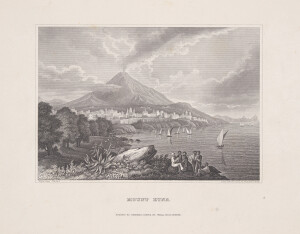 | SHORT DESCRIPTION: Black and white etching with possibly engraving titled “Mount Etna.” The image shows the volcano, Mount Etna in the background with smoke issuing from its summit. At its base sits the city of Catania. On the right side of the image, various small crafts, including felucca (one with a striped sail), are under sail before the town. In the foreground, a man dressed in white sits on a rock playing a lute with a group of men gathered before him. Two are sitting on rocks next to him, two are standing, and another is laying on the ground. A large rock surrounded by plants and flowers sits at the bottom center and trees sit at the bottom left. NOTE: From Volume one of Meyer’s Universum or View of The Most Remarkable Places and Objects of All Countries, in Steel Engravings by Distinguished Artists…” by Charles A. Dana, New York, Herrmann J. Meyer, 164 William Street, 1852. After page 238. | CL31491 | |||||||
| 3 | No image URL. | 1855 | Owners: Messrs. John Scott Russell and Co. Type of Incident: Fire Location of incident: Messrs. Scott Russell and Co. Work, Millway, England Incident Date: May 3, 1855 Casualties: None Source(s): Illustrated London News | MS0534/-02.06 | ||||||
| 4 | 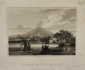 | SHORT DESCRIPTION: The print shows a view of Mount Etna with smoke rising from the summit, looking from the gardens at the estate of the Prince of Biscari in Catania, Italy. In the foreground on the right are a man and a woman with a cow. On the left in the water is a small boat with two sails. Just on the opposite shore is a building with stairs leading to the water and another ship nearby. In the distance rising above everything is Mount Etna. NOTES: The gardens are now called Giardino Bellini and are a public park on land once owned by the Castello family, the princes of Biscari. NOTES: Image is from before page 61 of volume 5 of John Pinkerton’s “A General Collection of the Best and Most Interesting Voyages and Travels in All Parts of the World; Many of Which are Now First Translated into English, Digested on a Plan,” published in 1809. This section of the book is titled “Spallanzani’s Travels in the Two Sicilies.” The text is from volume 1, page 193 of Abbe Lazzarro Spallanzani’s “Travels in the Two Sicilies, and Some Parts of the Apennines,” published in 1798. | CL16925 | |||||||
| 5 | 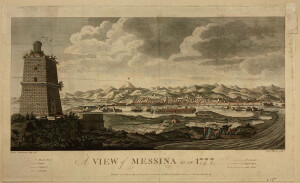 | SHORT DESCRIPTION: Hand colored engraving titled 'A view of Messina as in 1777'. The artist was Henry Swinburne, the engraver Peter Mazell. It was published by W. Faden in 1783. There is a key in the bottom margin that identifies buildings or important locations in and around the city (not by letters but by the number of birds flying over the location): Mount Etna, Citadel, Cathedral, Lazaretto, St. Salvador, Light House, and the Salt Ponds. NOTES: From: Travels in the Two Sicilies by Henry Swinburne, Esq, in the years 1777, 1778, 1779, and 1780, Vol. 2, London, Printed for P. Elmsley, in the Strand, 1783, after page 414. NOTES: Lighthouse established 1555. | CL10756 | |||||||
| 6 | No image URL. | VESSEL INFORMATION-- VESSEL NAME: USS WINOOSKI VESSEL TYPE: double-ended side-wheel gunboat SERVICE DATES: 1863- BUILDER LOCATION: Boston Navy Yard, Boston, Massachusetts VESSEL HISTORY: The hull of this vessel was built by the government and the machinery by Gardner & Lake of Providence, Rhode Island. Vessel was sold out of service on August 26th, 1868 to John Mullen for $19,100. ENGINE BUILDER AND LOCATION: Etna Iron Works, New York VESSEL DIMENSIONS: 205' (length), 35'(beam), 11'6" (depth); 974 tons; low pressure inclined engine with 59" cylinder diameter and 8'9" stroke; | CL20590 | |||||||
| 7 | 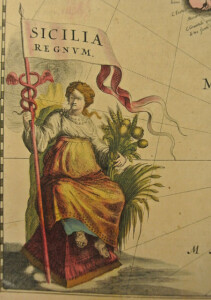 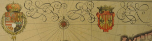 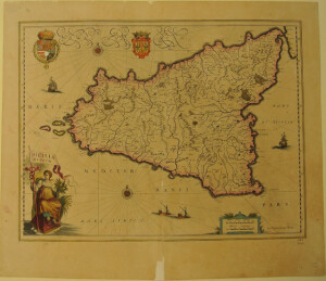 | 1640-1667 | Sicily (Italy) | woman holding flag with title; two coats of arms. The French text on the verso indicates this map was published in either a French edition of Le Théâtre du Monde, Volume 3 (published in 1640, 1644, 1645, 1647, 1650, and 1658) or a French edition of Le Grande Atlas, Volume 9 (published in 1663 and 1667). From John Goss, ed. Blaeu's The Grand Atlas of the 17th Century World (London: Rizzoli, 1990), 118: "Willem Blaeu issued this map of Sicily in 1635. The island had been under the rule of the Spanish line of the Habsburgs since 1479 and the island, together with the neighbouring Spanish-ruled parts of southern Italy, were important suppliers of wheat from the fertile lands on the volcanic soils around Etna. That fertility is symbolised in the figure of Ceres at the lower left, seen holding sheaves of corn. The Royal arms of Spain are included in the upper-left-hand corner." Dr. Ir. C. Koeman, Joan Blaeu and his Grand Atlas (Amsterdam: Theatrvm Orbis Terrarvm, 1970). | MSM 1/-#0220 | |||||
| 8 | 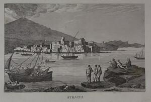 | SYRACUSE | CL15634 | |||||||
| 9 | 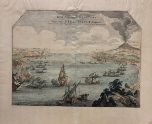 | NOTES: The publication "A List of Geographical Atlases in the Library of Congress" indicates this image was published in Volume three of Pierre Mortier's 1704 edition of Joannes Blaeu's ‘Novum Italiæ theatrum, sive Accurata descriptio ipsius urbium, palatiorum, sacrarum ædium, &c...', however, it is listed as plate 38. In the edition of ‘Novum Italiæ theatrum, sive Accurata description ipsius urbium, palatiorum, sacrarum ædium, &c...’ published by Rutgert Christophle Alberts in The Hague in 1724 it appears as plate 27 in volume three, which matches this image. NOTES: In ancient times Rhege (now Reggio Calabria) was one of the most renowned cities of Maga Graecia. It was ruined by an earthquake in 1783. NOTES: (excerpt from Daily Press, 8/15/1943) This reproduction of a colored line engraving . . .showing the Straits of Messina from the Northern end. City of Reggio, on the Italian mainland to the left; Messina on the Island of Sicily right wth Mount Etna about 30 miles distant. It is from an engraving by a the cartographer Pierre Mortier. . . NOTES: [Martha Wyatt, 05/08/2001] This print is from Joan Blaeu, Noveau theatri d'itale…, Amsterdam, 1704 (4 volumes). A member of the famous Dutch publishing family, in 1638 Joan Blaeu was appointed his father, Willem Janszoon Blaeu's, successor in the Hydrographic office of the V.O.C. (United East India Company). His attitude in the promotion of maritime cartography lacked the fervor of his industrious attitude towards geography. He aimed at full description of heaven, earth, and water, which was unachievable, but his efforts did culminate in the magnificent Atlas Major and the town-books of the Netherlands and of Italy (this is what we have). Works unsurpassed in history and in modern times, which gave eternal fame to the name of the Blaeus. In 1667 Joan Blaeu's printing house was moved and it was shortly after this in 1672 that a fire ruined the business. One year later Blaeu died. The fire and the passing of the director gave rise to the sale of the complete stock of the Blaeu House. The remainder of the printing business was handled by Blaeu's son until 1695 when it was sold at auction, bringing to an end to renowned Blaeu printing house. | CL15398 | |||||||
| 10 | No image URL. | Microfilm not cataloged. | There is a master and duplicate for each title. | LB84438 | ||||||
| 11 | No image URL. | This is a newspaper, double sheet, and has other captions. | CL17048 | |||||||
| 12 | 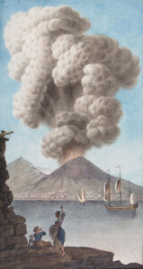 | SHORT DESCRIPTION: Etching hand-colored with gouache showing Mt. Vesuvius erupting on the morning of August 9, 1779 and the ‘magnificent column of smoke, which attended that eruption’. Four figures, two women and a child sit at the foreground watching the eruption, while a man watches from the top of a stone tower at the left. A ship is in the center under sail and a town is visible at the base of the volcano. The viewpoint is from Posillipo, a residential quarter on the west side of the Gulf of Naples. NOTES: Plate No. III taken from 'Supplement to Campi Phlegraei : being an account of the great eruption of Mount Vesuvius in the month of August 1779 by Hamilton, William, Sir, 1730-1803; Fabris, Peter. The description that accompanies the plate: View of the eruption of Mount Vesuvius Monday morning August the 9th 1779 and of the magnificent column of smoke, which attended that eruption; taken from an original drawing down from nature at Pausilipo by Mr. Peter Fabris. Hamilton employed the Anglo-Neapolitan artist Peter Fabris to create sketches in situ to illustrate the work. These were then reproduced in prints that were hand coloured individually by local artists by the application of gouache. The resultant work was published in 1776 (with a later supplement describing the great eruption of Vesuvius in August 1779) as Campi Phlegraei: Observations on the Volcanos of the Two Sicilies. NOTES: William Hamilton (1730-1803) British diplomat, archaeologist and volcanologist was elected a Fellow of the Royal Society in 1766 on the merit of his volcanic observations. He received the Copley Medal in 1770 for his 'Account of a Journey to Mount Etna'. Pietro Fabris (1740-1792) was a British artist who accompanied Hamilton around Mount Etna, Mount Vesuvius, and Lipari islands to document volcanic activities. NOTES: Excerpts from a blog post by Jessica Ball, a volcanologist at the U.S. Geological Survey: This is my favorite geologic illustration for a number of reasons. The first is simply aesthetic; it’s a lovely piece of work, and I particularly enjoy the observers in the foreground, for whom this seems to be an occurrence that merits a bit of sightseeing but not panic. But there are geologic aspects that I find intriguing as well. Fabri has captured not only the Plinian (or sub-Plinian) eruption column, but the ballistics falling out of the cloud (some of which must have been quite large, judging from the scale at which they’re depicted). In addition, he’s managed to show a vital process in the growth and maintenance of a volcanic plume – the entrainment and heating of outside air. This is occurring where Fabri shows the column curling in on itself, and it shows that this column was probably in its initial stages of formation, when there was still enough hot material (ash or hot gas jets) in the plume to trap and heat outside air. This heated air provides lift to the column, and allows it to grow to the impressive heights that we see in Plinian eruptions. Entrainment is part of what ‘feeds’ an eruption column, so seeing that Fabri and Hamilton took note of it even this early on in the development of volcanology is pretty exciting. I will note that some of his ballistic trajectories are a bit suspect – material falling out of an eruption column should pretty much just ‘rain’ out, and probably wouldn’t be arcing like the upper ballistics in this illustration. But the lower ones, which are presumably being expelled directly from the vent and not rising in the column, are doing precisely what they should. It’s also unlikely that the upper bombs are going to be the same size as the lower ones; material that rises in an eruption plume has to be light enough for the upward thrust of gases and hot air to push it that high in the first place, so bigger bombs will fall out earlier. (Want to see what paths ballistics follow depending on things like velocity, ejection angle and bomb size? Try the bomb trajectory simulation at Stromboli Online.) Finally, I always liked to think about the woman standing in the foreground. Who was she? What was she saying about the eruption? She doesn’t look particularly upset at the sight of a volcanic plume, but why is that? Has she seen so many that she’s jaded by them? (This eruptive period lasted for a decade, after all!) Is she describing something to her friends, or pointing out a feature of the plume? Or is she just a creation of the artist, there for scale and color and perhaps to balance the center of the image? Since it’s hard to find much information about the artist, we’ll probably never know anything about his subjects – or if they were even real. But it’s always fun to imagine things. | CL6867 | |||||||
| 13 | 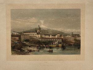 | SHORT DESCRIPTION: Hand colored engraving titled 'The city of Catania and Mount Aetna'. Engraved by W. Floyd; Drawn by W.L. Leitch. From volume 2 of "The Shores and Islands of The Mediterranean"; by Sir Grenville Temple, published by Fisher, Son, & Co., London. After page 142. | CL16403 | |||||||
| 14 | 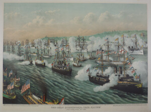 | SHORT DESCRIPTION: Appearing in the print are replicas of the SANTA MARIA, NINA and PINTA built in 1893, which were respectively towed over from Spain by the REGINA REGENTE, USS NEWARK and USS BENNINGTON. These boats were later exhibited at the Chicago Columbian exposition. VESSEL INFORMATION - VESSEL NAME: USS DOLPHIN VESSEL TYPE: Dispatch Boat, Patrol Gunboat LAUNCHED: April 12, 1884 COMMISSIONED: December 8, 1885 SERVICE DATES: 1885-ca 1927 DISPOSAL DATE: 1922 SHIPBUILDER: John Roach & Sons BUILDER LOCATION: Chester, Pennsylvania SHIP OWNER: US Navy (1884-1922); Mexican Navy (1922-ca 1927) VESSEL HISTORY: USS Dolphin (PG-24) was launched April 12, 1884 by John Roach & Sons of Chester, PA. She was part of the New Navy, the new steel ships (rather than iron) built for the U.S. Navy. She was stationed with the North Atlantic Station and the Squadron of Evolution. She carried the Secretary of the Navy, the President, and attended various celebrations. Dolphin participated in the blockade of Havana in April and May of 1898, then moved to Santiago where the ship came under fire from Castillo de San Pedro de la Roca (see 1998.33.26) on June 6. Dolphin returned to Norfolk July 2, 1898. Dolphin remained in the Caribbean throughout WWI, and was eventually sold to Mexico in 1922. The ship’s name became the Plan de Guadalupe, and she was scrapped around 1927. MAJOR EVENTS: Spanish-American War, WWI ALTERNATE VESSEL NAMES: USS Dolphin (1884-1922); Plan de Guadalupe (1922-ca 1927) DISPOSAL DATE: ca 1927 | CL18429 | |||||||
| 15 | 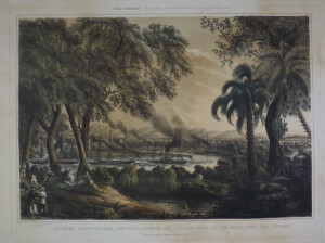 | SHORT DESCRIPTION: Tinted or toned lithograph highlighted with watercolor. Number 5 of a series of eight lithographs by Lt. Henry Walke depicting naval actions in the Mexican War in the spring and summer of 1847. The image is titled "The Naval Expedition under Commodore Perry, Ascending the Tabasco River at the Devils Bend. June 15th 1847". The images were published by Sarony & Major in New York. NOTES: This lithograph is from the estate of Francis Patrick Garvan (1875-1937). Most of whose art and silver collection went to Yale University and the Colonial Williamsburg Foundation. NOTES: Based upon a sketch by an eyewitness participant, U.S. Navy Lieutenant Henry Walke, ships of the "Mosquito Fleet" from left to right may be identified as the three-masted side-wheel steamer Scorpion, bearing Commodore Perry's broad pennant, the brig Washington, the bomb brig Vesuvius (Walke's ship), followed by several smaller launches; in the center, the paddle boxes and double masts of what is most likely the Spitfire, in front and to the side of which is one of the bomb brigs, Etna or Stromboli. Farther around the bend are steamers Vixen and Scourge flanked and followed by smaller vessels. NOTES: Lieutenant Henry Walke, USN, the artist of this series of prints was a Virginian whose original entry in the U.S. Navy Service was February 1, 1827. NOTES: The event shown in this lithograph was discussed by William Elliot Griffis in his biography 'Matthew Calbraith Perry, A Typical American Naval Officer', pages 241-243: THE NAVAL BRIGADE. CAPTURE OF TABASCO. From various points on the coast, the ships and steamers assembled like magic, and on Monday morning, June 14, 1847, the squadron came to anchor off the mouth of the Tabasco river. The detachments from eleven vessels, numbering 1084 seamen and marines in forty boats, were under the Commodore’s immediate direction and command. He had prepared the plan of attack with great care. Every contingency was foreseen and provided against, and the minutest details were subject to his thoughtful elaboration. At that point of the river called the Devil’s Bend, danger was apprehended. Here the dense chapparal feathered down to the river’s edge affording a splendid opportunity for ambush. The alert Commodore was standing on the upper waist deck of the Scorpion under the awnings entirely exposed, on the look-out for the enemy. Suddenly, as the flag-ship reached the elbow, from the left side of the river the guns of at least a hundred men blazed forth in a volley, followed by a dropping fire. In an instant the awnings were riddled and all the upper works of wood and iron scratched, dented, and splintered, by the spatter of lead and copper. Strange to say, not a single man on the Scorpion was touched by the volley though a sailor on the Vesuvius was hit later. As the smoke curled up from the chapparal, Perry pointed with his glass to the guns still flashing, and gave, or rather roared out, the order “Fire.” The guns of the Scorpion, Washington and the surf-boats, with a rattling fusillade of small arms, soon mowed great swaths in the jungle. From the masthead of the Stromboli, a number of cavalry were seen beyond the jungle. A ten-inch shell, from the eight-ton gun of the Vesuvius, exploding among them, seemed to the enemy to be an attack in the rear, cutting off their retreat, and they scattered wildly. Very few of the Mexicans took time to reload or fire a second shot. It was now past six o’clock and it was determined to anchor for the night. The whole squadron assembled in the Devil’s Turn, and anchored in sight of the Seven Palm Trees below which the obstructions had been sunk. Due precautions were taken against a night attack, as the dense chapparal was only twenty yards distant. A barricade of hammocks was therefore thrown up on the bulwarks for protection, and the sailors, as soldiers are, in rhetoric, said to do, “slept on their arms.” But one volley was received from the shore during the night, the air only receiving injury. NOTES: The complete series of Lt. Walke's images includes: 1. The U.S. Steam Frigate Mississippi, Comre. M.C. Perry [LP 3751] 2. The U.S. Naval Expedition under Comore. M.C. Perry [LP 3752] 3. The U. States Steamers, Scorpion, Spitfire, Vixen, and Scourge, with 40 Barges in Tow, crossing the Bar at the Mouth of Tabasco River, Mexico [LP 508] 4. The Attack of the Mexicans from the Chapperal, on the First Division of the Naval Expedition to Tabasco (Mexico) [LP 3753] 5. The Naval Expedition under Comre. Perry, ascending the Tabasco River at the Devils Bend, June 15th 1847 [LP 3754] 6. The Landing, of the Naval Expedition, against Tabasco, (Mexico.) Commore. M.C. Perry in Command [LP 515] 7. The Capture of the City of Tabasco, by the U.S. Naval Expedition, afloat and on shore, under Commore. M.C. Perry [LP 3755] 8. The U.S. Naval Battery during the Bombardment of Vera Cruz on the 24 and 25 of March 1847 [LP 511] | CL7913 | |||||||
| 16 | 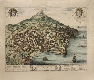 | NOTES: The publication "A List of Geographical Atlases in the Library of Congress" indicates this image was published in Volume three of Pierre Mortier's 1704 edition of Joannes Blaeu's ‘Novum Italiæ theatrum, sive Accurata descriptio ipsius urbium, palatiorum, sacrarum ædium, &c...', however, it is listed as plate 42. In the edition of ‘Novum Italiæ theatrum, sive Accurata description ipsius urbium, palatiorum, sacrarum ædium, &c...’ published by Rutgert Christophle Alberts in The Hague in 1724 it appears as plate 30 in volume three, which matches this image. NOTES: There are forty-six numbered references in six columns in the bottom margin. To the left of the title at the bottom there is a scene of the torture of Agatha, part of which involved the excision of her breasts with pincers. On the right side of the frame another man holds several pairs of pincers which others appear to be being heated in a cart at his feet. NOTES: [Martha Wyatt, 05/08/2001] This print is from Joan Blaeu, Noveau theatri d'itale..., Amsterdam, 1704 (4 volumes). A member of the famous Dutch publishing family, in 1638 Joan Blaeu was appointed his father, Willem Janszoon Blaeu's, successor in the Hydrographic office of the V.O.C. (United East India Company). His attitude in the promotion of maritime cartography lacked the fervor of his industrious attitude towards geography. He aimed at full description of heaven, earth, and water, which was unachievable, but his efforts did culminate in the magnificent Atlas Major and the town-books of the Netherlands and of Italy (this is what we have). Works unsurpassed in history and in modern times, which gave eternal fame to the name of the Blaeus. In 1667 Joan Blaeu's printing house was moved and it was shortly after this in 1672 that a fire ruined the business. One year later Blaeu died. The fire and the passing of the director gave rise to the sale of the complete stock of the Blaeu House. The remainder of the printing business was handled by Blaeu's sons until 1695 when it was sold at auction, bringing to an end to renowned Blaeu printing house. | CL15397 | |||||||
| 17 | SHORT DESCRIPTION: Watercolor drawing by Joseph Partridge titled "Port of Catania." The image is shows as if the viewer was standing on a point of land and looking over the water towards the town. The town spreads along the shoreline and a smoking, but snow capped, Mount Etna sits at the center behind the town. There are a number of domes within the town; the blue dome may be the Catania Cathedral (Duomo di Catania; Cattedrale di Sant'Agata). NOTES: Joseph Partridge was born in England in 1792. In 1817 he moved to Halifax, Nova Scotia where he taught water color drawing. He moved to Boston in 1820 and then to Providence, Rhode Island where he again advertised for students who wished to learn watercolor drawing. By 1824 Partridge was living in abject poverty and was forced to move his small family to Taunton, Massachusetts where he again advertised for art students. On August 26, 1825 at the age of 33 Partridge enlisted at Charlestown, Massachusetts for five years as a Private in the US Marine Corps. His occupation on his enlistment papers was “anatomical painter.” Following his enlistment Partridge reported to the Charlestown Navy Yard and remained there until January 1, 1827 when he was assigned to the USS Warren. Partridge served aboard the ship for three years and it was during this time that he produced his greatest body of work—watercolors depicting places visited in the Mediterranean and one of the USS Warren. Several images by Partridge were engraved by Francis Kearny “from an original drawing done under the direction of an officer of the US Navy.” One of the three notes that the image was originally drawn by “J. Partridge.” As all of the images were done at the same time under the same circumstances it leaves little doubt that Partridge was the artist of all of the images. Another artwork supporting this supposition is an engraving by Kearny titled “Napoli de Romania” which bears the inscription “from an original drawing, done under the direction of an office of the US Navy, 1827” is based on the Partridge watercolor of the same name that is signed and dated 1827. Kearny was the brother of Lawrence Kearny, commanding officer of the USS Warren. Partridge detached from the Warren on March 10, 1830 and reported aboard the USS Lexington the following day. The Lexington was also on the Mediterranean Station. He detached from the Lexington on April 14th and two days later appears aboard the USS Java (Mediterranean Station). Following his detachment on June 8 he reported back to the USS Warren three days later at Port Mahon. The ship returned to the United States that summer and Partridge was honorably discharged from the US Marine Corps at Gosport, Virginia on October 18, 1830 with the rank of sergeant. Partridge appears to have died at some point between his discharge and 1833. VESSEL INFORMATION: VESSEL NAME: USS Warren VESSEL TYPE: SLOOP OF WAR BUILD DATE: 1825-1827 BUILDER: BOSTON NAVY YARD COMMISSIONED: January 14, 1827 DIMENSIONS: 127’ length, 33-9” depth, 697 tons VESSEL HISTORY: The USS Warren was a second-class 697-ton sloop-of-war built at the Boston Navy Yard between 1825 and 1827 and was commissioned at her builders on 14 January 1827, Master Commandant Lawrence Kearny in command. The ship was decommissioned on May 24, 1859 and sold on January 1, 1863. USS Warren sailed for the Mediterranean on February 22, 1827 tasked with protecting American merchantmen from Greek-flagged pirates. To protect American vessels the US Navy’s Mediterranean Squadron established a regular convoy system from Malta to Smyrna. Warren sailed with a convoy of American vessels on September 25, 1827 but separated from them some 200 miles west of Kythira to begin hunting pirates. Her first captures occurred on October 4th, with a small "piratical boat" crewed by five and a brig "peerced (sic) for 16 guns." Warren cruised between Cape Matapan and Carabusa for the next three weeks, only occasionally contacting the outward-bound American merchantmen. On October 25th while off Milos, Kearny learned of recent pirate attacks on the American ships Cheru and Rob Roy. That same day, Warren chased a 10-gun pirate brig ashore at the island of Kimolos; but the pirates escaped into the nearby hills. Warren's men cut away the vessels masts and stripped them of their sails, leaving the rigging submerged in the waters offshore. Three days later, Warren came across Cherub and took possession of her. That evening, the brig Lexington arrived and assumed protective guard over Cherub while Warren continued to hunt for pirate vessels. The next day, between Tinos and Mykonos, Warren discovered the Austrian brig Silence" robbed of everything." Warren towed Silence to Syros and left her in care of USS Lexington. Cruising around the island of Mykonos, Warren captured a large tratta "capable of rowing 40 oars," before she put into Mykonos harbor on November 1st. The following day, Kearny and his men recovered sails and some property taken from Cherub and two cases of opium taken from the brig Rob Roy, as well as the sails and rigging from Silence. The local inhabitants turned over four men accused of being pirates while a landing party of Warren men picked up a fifth man in the mountains. Kearny and his men also took possession of a boat belonging to pirates living at Mykonos and later burned it. The ship returned to Syros on November 7th and Kearny restored the goods to Cherub and the sails and rigging from the Austrian ship. Cherub, escorted by Lexington, set sail for Smyrna. That evening, Warren put to sea, bound for the island of Andros. Kearny organized a boat expedition led by Lieutenant William L. Hudson to circle Andros Island. Near the south end of the town of Andros, the captured one small "piratical craft" and burned another. The American sailors also blew up a house believed to have been owned by a pirate and raised and took possession of a boat which had been sunk by pirates to avoid detection by the Americans. Rob Roy's master later identified the boat as the craft that had attacked his vessel. Warren remained in the vicinity of Andros and Gioura until November 14. The people of Andros again cooperated and produced a pirate boat which contained a 12-pounder carronade and some tools from Cherub. Four days later, Warren entered the port at Milos and stayed there until late November. On the 27th of that month, the American brig Sarah and Esther and six other vessels arrived. Three days later, that convoy sailed for Smyrna under Warren's protection. They arrived at their destination, without incident, on 6 December. Warren remained in the western Mediterranean guarding American commerce for the next two years. Captain Kearny left the vessel in late June 1829 while the ship was at Port Mahon. Warren arrived at Norfolk, Virginia, on August 30, 1830 and was decommissioned for repairs, on September10th. Warren was recommissioned on September 2, 1831, for service on the Brazil Station. After two years in the South Atlantic, Warren headed northward and reached Philadelphia, on October 31,1833. Warren then made three successive tours in the West Indies, protecting American commerce in deployments that began in 1836 with the West Indies Squadron and with the Home Squadron in 1839, and 1841. On October 19, 1843, Warren sailed for service with the Pacific Squadron and remained on the western coast for the remainder of her naval career. Warren was sold at Panama on January 1,1863. ADDITIONAL INFORMATION: SEE “Joseph Partridge, painter” by Arthur B. and Sybil B. Kern. Published in The Magazine Antiques, September 1984, pages 582-589. SEE object file for Daily Press article dated July 18, 1943. | CL12751 | ||||||||
| 18 | 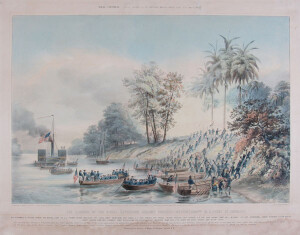 | SHORT DESCRIPTION: Tinted or toned lithograph highlighted with watercolor. Number 6 of a series of eight lithographs by Lt. Henry Walke depicting naval actions in the Mexican War in the spring and summer of 1847. The image is titled "The landing of the Naval Expedition, against Tabasco, (Mexico)". The images were published by Sarony & Major in New York. NOTES: Lieutenant Henry Walke, USN, the artist of this series of prints was a Virginian whose original entry in the U.S. Navy Service was February 1, 1827. NOTES: The event shown in this lithograph was discussed by William Elliot Griffis in his biography 'Matthew Calbraith Perry, A Typical American Naval Officer' on pages 241 to 250. NOTES: The complete series of Lt. Walke's images includes: 1. The U.S. Steam Frigate Mississippi, Comre. M.C. Perry [LP 3751] 2. The U.S. Naval Expedition under Comore. M.C. Perry [LP 3752] 3. The U. States Steamers, Scorpion, Spitfire, Vixen, and Scourge, with 40 Barges in Tow, crossing the Bar at the Mouth of Tabasco River, Mexico [LP 508] 4. The Attack of the Mexicans from the Chapperal, on the First Division of the Naval Expedition to Tabasco (Mexico) [LP 3753] 5. The Naval Expedition under Comre. Perry, ascending the Tabasco River at the Devils Bend, June 15th 1847 [LP 3754] 6. The Landing, of the Naval Expedition, against Tabasco, (Mexico.) Commore. M.C. Perry in Command [LP 515] 7. The Capture of the City of Tabasco, by the U.S. Naval Expedition, afloat and on shore, under Commore. M.C. Perry [LP 3755] 8. The U.S. Naval Battery during the Bombardment of Vera Cruz on the 24 and 25 of March 1847 [LP 511] | CL17650 | |||||||
| 19 | 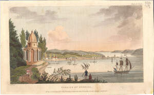 | SHORT DESCRIPTION: Hand-colored engraving titled the "Straits of Messina" published in Rudolph Ackermann's ' Repository of Arts, Literature, Commerce, Manufactures, Fashions, and Politics'. the image shows the church of Santa Maria Della Grotta at the left. Two men in Royal Marine uniforms stand on the road leading to the church gesturing out to the strait. In the foreground stands a fisherman casting a net, while a sits on the ground beside him. In the background is the busy Strait of Messina, which many small craft and a small British warship at the lower right. The strait is lined with low hills, on the left shore are houses and trees. NOTES: From: 'The Repository of Arts, Literature, Commerce, Manufactures, Fashions, and Politics,' 1st series, vol. 4, July–December 1810. It appears as plate 34 in the December edition, number 24, after page 350. The text accompanying the image reads (pages 350-352): PLATE 34.-DESCRIPTION OF THE STRAITS OF MESSINA. No one portion of the terraqueous globe has been so often celebrated, or so frequently been the scene of remarkable events, as the Straits of Messina, and the coasts which form them. They were first described by Homer, at once the greatest and most ancient of poets and historians. He has been followed by almost all the classic writers of Greece and Rome, as well as by the most celebrated among the moderns. But the subject, so far from being exhausted, is likely to prove a fertile source of materials for future authors. History and tradition, as well as philosophy and reason, concur in ascribing the formation of these straits to a tremendous convulsion of the earth, which rent the island of Sicily from the Continent. This dreadful earthquake most probably happened at the same remote period of time, when the subterraneous fires first found vent, and formed the burning mountains of Vesuvius and Etna; whilst the rocks of Scylla, and the whirlpool of Charybdis, owing to the same cause, composed a union of the most terrific objects in nature. Of all the ancient writers on these phenomena, Virgil alone describes the cause and the effect. "Hæc loca, vi quondam et vasta convulsa ruina, Tantum evi longinqua valet mutare vetustas! Dissiluisse ferunt, quum protenus utraque tellus Una foret: venit medio vi pontus et undis Hesperium Siculo latus abscidit, arvaque et urbes Littore diductas angusto interluit asta. Dextram Scylla latus, levam implacata Charybdis, Obsidet, atque imo barathri ter gurgite vastos Sorbit in abruptum fluctus, rursusque sub auras Eregit alteroos, et sidera verberat unda, At Scyllam coris cohibet spelunca latebris Ora exsertantem, et naves in saxa trabentem. EN. lib. iii. v. 414. " The dangers attending the navigation of these straits in ancient times, were not altogether poetic fictions. Before the invention of the compass, sailing was only attempted along shore; but all the skill and exertions of the best mariners were often of no avail in navigating this celebrated passage; for in avoiding the rocks of one coast, a more destructive whirlpool was ready to swallow up the vessel on the other. Hence arose the famous proverb, applied to persons who, to escape a threatened danger, rush into the opposite: Iucidit in Scyllam cupiens viture Charybdim. In the present day, however, these perils no longer exist. The rocks of Scylla rise out of smooth water (except at particular seasons), and Charybdis is only supposed to exist in a rippling tide, which is perceived off the point of the Faro of Messina. It is a subject worthy of investigation, to ascertain the causes which have rendered a passage through the straits at present so comparatively easy and safe. It is supposed, that, from the constant force and attrition of the currents, the channel has become wider, and, consequently, the stream less violent. But the true cause seems to be the frequent earthquakes which have changed the whole face of the country, and doubtless occasioned alterations to the very bottom of the sea. The last earthquake of 1783 was the most terrible on record: it overthrew most of the cities and towns on the coast of Calabria and on the east coast of Sicily, and buried about 60,000 of the inhabitants in the ruins. But although the passage through the straits is no longer dangerous, yet it very often happens that the transit cannot be effected without a leading wind; for there is always a strong current setting up the straits from the promontory of Scylla, which, in the narrows, is so very powerful as to require a stiff breeze to stem it. There are, besides, particular periods when the channel becomes violently agitated: these are at the equinoxes, and about mid-summer and mid-winter. For all these reasons, the transit from Italy is generally made at the widest part of the straits, namely, from Reggio to Messina, which is about seven miles across; or from the former to Taurementum, which is as many more. Thus is the preservation of Sicily owing to the shortness of the distance of the hostile coast; for it is this which makes the passage intricate, whilst the preparations of the enemy are constantly overlooked by those who are to oppose them. The annexed view was taken from a handsome church called Il Grutta [Santa Maria della Grotta], midway between the city of Messina and Il Torre del Faro, where the straits are narrowest, being there little better than a mile. and a half across. The Faro tower is situated on Cape Peloro (olim Pelorus), a long, low isthmus, which forms the north-west entrance. The opposite shore of Calabria is bold, high, and wooded; the whole resembles one of the great rivers of America. The north-east entrance is made by the famous rock of Scylla, distant from the Faro about two miles and a half. This rock, or promontory, is separated from the Continent by a deep ravine. It is surrounded by a number of smaller rocks; among which, in stormy weather, the sea makes a tremendous bellowing. The summit is crowned by the castle of Scylla, and the town of Scigleo is built on the sides. The English kept possession of this castle a long time in the midst of the enemy; at length he got his guns to bear on it from the adjacent heights, and we were compelled to abandon it. Both castle and town were much damaged by the earthquake of 1785, when the refluent sea swept away above 3000 people from the beach. If the island of Sicily constituted an integral part of the British dominions (and why it should not in the present times, no good reason can be adduced), it would not be difficult to prove, that it would become more valuable than all the foreign possessions of Great Britain, even including India, put together. Its natural productions of grain, oil, wine, and silk, might, by British industry and under British laws, be made to supply, not England only, but all Europe. Nature in vain has lavished all her bounties on this favoured country: they are abused or neglected by its wretched inhabitants, and still more wretched government. The Sicilians were never a free people, with the exception of the short, but brilliant independence of Syracuse and Agrigentum. They became successively the slaves of the Greeks, Carthaginians, Romans, Saracens, and Normans. In later times, the sovereignty of the island became the constant object of contention between the French and Spanish monarchies, who tyrannized over the country by turns. It is no wonder, therefore, that such a people should have lost every sentiment of freedom, become ignorant of its meaning, and utterly insensible of the energies it inspires. Sicily, with respect to Italy, is situated like Great Britain and France. If, then, we maintain possession of this fine island with a handful of troops, assisted by a flotilla and a few frigates, and defy the utmost efforts of the enemy to invade it, how absurd is it to entertain apprehensions for the invasion of the British Isles! [authored by] E. W. | CL27143 | |||||||
| 20 | 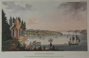 | SHORT DESCRIPTION: Hand-colored engraving titled the "Straits of Messina" published in Rudolph Ackermann's ' Repository of Arts, Literature, Commerce, Manufactures, Fashions, and Politics'. the image shows the church of Santa Maria Della Grotta at the left. Two men in Royal Marine uniforms stand on the road leading to the church gesturing out to the strait. In the foreground stands a fisherman casting a net, while a sits on the ground beside him. In the background is the busy Strait of Messina, which many small craft and a small British warship at the lower right. The strait is lined with low hills, on the left shore are houses and trees. NOTES: From: 'The Repository of Arts, Literature, Commerce, Manufactures, Fashions, and Politics,' 1st series, vol. 4, July–December 1810. It appears as plate 34 in the December edition, number 24, after page 350. The text accompanying the image reads (pages 350-352): PLATE 34.-DESCRIPTION OF THE STRAITS OF MESSINA. No one portion of the terraqueous globe has been so often celebrated, or so frequently been the scene of remarkable events, as the Straits of Messina, and the coasts which form them. They were first described by Homer, at once the greatest and most ancient of poets and historians. He has been followed by almost all the classic writers of Greece and Rome, as well as by the most celebrated among the moderns. But the subject, so far from being exhausted, is likely to prove a fertile source of materials for future authors. History and tradition, as well as philosophy and reason, concur in ascribing the formation of these straits to a tremendous convulsion of the earth, which rent the island of Sicily from the Continent. This dreadful earthquake most probably happened at the same remote period of time, when the subterraneous fires first found vent, and formed the burning mountains of Vesuvius and Etna; whilst the rocks of Scylla, and the whirlpool of Charybdis, owing to the same cause, composed a union of the most terrific objects in nature. Of all the ancient writers on these phenomena, Virgil alone describes the cause and the effect. "Hæc loca, vi quondam et vasta convulsa ruina, Tantum evi longinqua valet mutare vetustas! Dissiluisse ferunt, quum protenus utraque tellus Una foret: venit medio vi pontus et undis Hesperium Siculo latus abscidit, arvaque et urbes Littore diductas angusto interluit asta. Dextram Scylla latus, levam implacata Charybdis, Obsidet, atque imo barathri ter gurgite vastos Sorbit in abruptum fluctus, rursusque sub auras Eregit alteroos, et sidera verberat unda, At Scyllam coris cohibet spelunca latebris Ora exsertantem, et naves in saxa trabentem. EN. lib. iii. v. 414. " The dangers attending the navigation of these straits in ancient times, were not altogether poetic fictions. Before the invention of the compass, sailing was only attempted along shore; but all the skill and exertions of the best mariners were often of no avail in navigating this celebrated passage; for in avoiding the rocks of one coast, a more destructive whirlpool was ready to swallow up the vessel on the other. Hence arose the famous proverb, applied to persons who, to escape a threatened danger, rush into the opposite: Iucidit in Scyllam cupiens viture Charybdim. In the present day, however, these perils no longer exist. The rocks of Scylla rise out of smooth water (except at particular seasons), and Charybdis is only supposed to exist in a rippling tide, which is perceived off the point of the Faro of Messina. It is a subject worthy of investigation, to ascertain the causes which have rendered a passage through the straits at present so comparatively easy and safe. It is supposed, that, from the constant force and attrition of the currents, the channel has become wider, and, consequently, the stream less violent. But the true cause seems to be the frequent earthquakes which have changed the whole face of the country, and doubtless occasioned alterations to the very bottom of the sea. The last earthquake of 1783 was the most terrible on record: it overthrew most of the cities and towns on the coast of Calabria and on the east coast of Sicily, and buried about 60,000 of the inhabitants in the ruins. But although the passage through the straits is no longer dangerous, yet it very often happens that the transit cannot be effected without a leading wind; for there is always a strong current setting up the straits from the promontory of Scylla, which, in the narrows, is so very powerful as to require a stiff breeze to stem it. There are, besides, particular periods when the channel becomes violently agitated: these are at the equinoxes, and about mid-summer and mid-winter. For all these reasons, the transit from Italy is generally made at the widest part of the straits, namely, from Reggio to Messina, which is about seven miles across; or from the former to Taurementum, which is as many more. Thus is the preservation of Sicily owing to the shortness of the distance of the hostile coast; for it is this which makes the passage intricate, whilst the preparations of the enemy are constantly overlooked by those who are to oppose them. The annexed view was taken from a handsome church called Il Grutta [Santa Maria della Grotta], midway between the city of Messina and Il Torre del Faro, where the straits are narrowest, being there little better than a mile. and a half across. The Faro tower is situated on Cape Peloro (olim Pelorus), a long, low isthmus, which forms the north-west entrance. The opposite shore of Calabria is bold, high, and wooded; the whole resembles one of the great rivers of America. The north-east entrance is made by the famous rock of Scylla, distant from the Faro about two miles and a half. This rock, or promontory, is separated from the Continent by a deep ravine. It is surrounded by a number of smaller rocks; among which, in stormy weather, the sea makes a tremendous bellowing. The summit is crowned by the castle of Scylla, and the town of Scigleo is built on the sides. The English kept possession of this castle a long time in the midst of the enemy; at length he got his guns to bear on it from the adjacent heights, and we were compelled to abandon it. Both castle and town were much damaged by the earthquake of 1785, when the refluent sea swept away above 3000 people from the beach. If the island of Sicily constituted an integral part of the British dominions (and why it should not in the present times, no good reason can be adduced), it would not be difficult to prove, that it would become more valuable than all the foreign possessions of Great Britain, even including India, put together. Its natural productions of grain, oil, wine, and silk, might, by British industry and under British laws, be made to supply, not England only, but all Europe. Nature in vain has lavished all her bounties on this favoured country: they are abused or neglected by its wretched inhabitants, and still more wretched government. The Sicilians were never a free people, with the exception of the short, but brilliant independence of Syracuse and Agrigentum. They became successively the slaves of the Greeks, Carthaginians, Romans, Saracens, and Normans. In later times, the sovereignty of the island became the constant object of contention between the French and Spanish monarchies, who tyrannized over the country by turns. It is no wonder, therefore, that such a people should have lost every sentiment of freedom, become ignorant of its meaning, and utterly insensible of the energies it inspires. Sicily, with respect to Italy, is situated like Great Britain and France. If, then, we maintain possession of this fine island with a handful of troops, assisted by a flotilla and a few frigates, and defy the utmost efforts of the enemy to invade it, how absurd is it to entertain apprehensions for the invasion of the British Isles! [authored by] E. W. | CL16743 | |||||||
| 21 | 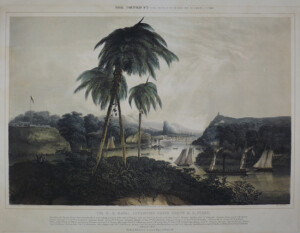 | SHORT DESCRIPTION: Tinted or toned lithograph. Number 2 of a series of eight lithographs by Lt. Henry Walke depicting naval actions in the Mexican War in the spring and summer of 1847. The image is titled "The U.S. Navy Expedition Under Commodore M.C. Perry, Ascending the Tuspan river, destroying the Forts, and taking possesion [sic] of the Port of Tuspan". The images were published by Sarony & Major in New York. NOTES: This lithograph is from the estate of Francis Patrick Garvan (1875-1937). Most of whose art and silver collection went to Yale University and the Colonial Williamsburg Foundation. NOTES: Lieutenant Henry Walke, USN, the artist of this series of prints was a Virginian whose original entry in the U.S. Navy Service was February 1, 1827. Number 2 of a series of eight. Tinted or toned lithograph, highlighted with watercolor. NOTES: The event shown in this lithograph was discussed by William Elliot Griffis in his biography 'Matthew Calbraith Perry, A Typical American Naval Officer' on pages 241-243: THE NAVAL BRIGADE. CAPTURE OF TABASCO. Commodore Matthew C. Perry was one of the first American naval officers to overcome the prejudice of seamen against infantry drill, and to form a corps of sailor-soldiers. Under his predecessor, the navy had lost more than one opportunity of gaining distinction because unable to compete with infantry, or to face cavalry in the open field. Perry formed the first United States naval brigade, though Stockton in California employed a few of his sailors as marines in garrison. The men of Perry's brigade numbering twenty-five hundred, with ten pieces of artillery, were thoroughly drilled first in the manual of arms and then in company and battalion formations under his own eye. His first employment of part of this body was at Tuspan. Twenty-two days after the fall of Vera Cruz, and on the day of the battle of Cerro Gordo, the bar at the river's mouth was crossed by the light ships, the fort stormed, and Tuspan 'taken at a gallop!' Obliged to give up his marines to General Franklin Pierce, Perry drilled his sailors all the more, so that little leisure was allowed them. The capture of Tabasco involved the problem of fighting against infantry, posted behind breastworks, with sailors. This was somewhat novel work for our navy. Hitherto all our naval traditions were of squadron fights in line, ship-to-ship duels, or boat expeditions. In the present case the flotilla was to ascend a narrow and torturous river to the distance of nearly seventy miles through an enemy's country densely covered with vegetation that afforded a continuous cover for riflemen, and then to attack heavy shore batteries. From various points on the coast, the ships and steamers assembled like magic, and on Monday morning, June 14, 1847, the squadron came to anchor off the mouth of the Tabasco river. The detachments from eleven vessels, numbering 1084 seamen and marines in forty boats, were under the Commodore's immediate direction and command. He had prepared the plan of attack with great care. Every contingency was foreseen and provided against, and the minutest details were subject to his thoughtful elaboration. At that point of the river called the Devil's Bend, danger was apprehended. Here the dense chapparal feathered down to the river's edge affording a splendid opportunity for ambush. The alert Commodore was standing on the upper waist deck of the Scorpion under the awnings entirely exposed, on the look-out for the enemy. Suddenly, as the flag-ship reached the elbow, from the left side of the river the guns of at least a hundred men blazed forth in a volley, followed by a dropping fire. In an instant the awnings were riddled and all the upper works of wood and iron scratched, dented, and splintered, by the spatter of lead and copper. Strange to say, not a single man on the Scorpion was touched by the volley though a sailor on the Vesuvius was hit later. As the smoke curled up from the chapparal, Perry pointed with his glass to the guns still flashing, and gave, or rather roared out, the order "Fire." The guns of the Scorpion, Washington and the surf-boats, with a rattling fusillade of small arms, soon mowed great swaths in the jungle. From the masthead of the Stromboli, a number of cavalry were seen beyond the jungle. A ten-inch shell, from the eight-ton gun of the Vesuvius, exploding among them, seemed to the enemy to be an attack in the rear, cutting off their retreat, and they scattered wildly. Very few of the Mexicans took time to reload or fire a second shot. NOTES: The complete series of Lt. Walke's images includes: 1. The U.S. Steam Frigate Mississippi, Comre. M.C. Perry [LP 3751] 2. The U.S. Naval Expedition under Comore. M.C. Perry [LP 3752] 3. The U. States Steamers, Scorpion, Spitfire, Vixen, and Scourge, with 40 Barges in Tow, crossing the Bar at the Mouth of Tabasco River, Mexico [LP 508] 4. The Attack of the Mexicans from the Chapperal, on the First Division of the Naval Expedition to Tabasco (Mexico) [LP 3753] 5. The Naval Expedition under Comre. Perry, ascending the Tabasco River at the Devils Bend, June 15th 1847 [LP 3754] 6. The Landing, of the Naval Expedition, against Tabasco, (Mexico.) Commore. M.C. Perry in Command [LP 515] 7. The Capture of the City of Tabasco, by the U.S. Naval Expedition, afloat and on shore, under Commore. M.C. Perry [LP 3755] 8. The U.S. Naval Battery during the Bombardment of Vera Cruz on the 24 and 25 of March 1847 [LP 511] | CL7911 | |||||||
| 22 | 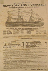 | NOTES: The Liverpool, New York & Philadelphia Steamship Company was the well known Inman Line. The date of this broadside must have been about 1863 after the CITY OF CORK & CITY OF LIMERICK were added to the line and before the service of the Iman Line became more frequent than once a week. This object is very fragile being printed on tissue. VESSEL INFORMATION-- VESSEL NAME: CITY OF GLASGOW VESSEL TYPE: prototype of iron screw steamer; clipperbow, 1 funnel, 3 mast SERVICE DATES:1849-1854 VESSEL HISTORY:Maiden voyage from Glasgow to New York(operated by builders) on April 15, 1850. October 5, 1850: 4th and last voyage for builders. Vessel then sold to Liverpool & Philadelphia Steamship Co. December 11, 1850: first voyage for new owners from Liverpool to Philadelphia. It took 22 days westward. March1, 1854: Last voyage from Liverpool. Vessel disappeared without a trace with 480 passengers and crew aboard. VESSEL DIMENSIONS: 1,609 gross tons; 227' (length) x 34' (beam); 2 cylinder; 66" bore x 60" stroke; 310 h.p.; single screw 13.5'(diameter); 9 knots. VESSEL INFORMATION-- VESSEL NAME:CITY OF MANCHESTER VESSEL TYPE: steamship; iron construction, clipper bow, 1 funnel, 4 masts DATE WRECKED:1876 SHIP LINE: Inman Line VESSEL HISTORY: 1851: vessel sold to Inman Lne upon completion(Inman's second ship). July 18, 1851: maiden voyage from Liverpool to Philadelphia. 1854: vessel chartered by French Government ot transport troops to Crimea. August 13,1856: North Atlantic service resumed. 1857: vessel emplyed by British government to transport troops to Indian Mutiny. April, 1859: Atlantic servic e resumed with experimental stop at Queenstown, Ireland to bid for emigrant trade to United States. December 1859: Vessel transferred to Glasgow/New York run, but returned to Liverpool sailing after one voyage. 1862: New boiler installed after 48 round truips across the North Atlantic. January 9,1871:Last voyage to New York and back. Vessel sold and engines removed. 1876: vessel finally wrecked. VESSEL DIMENSIONS:1,892 gross tons, 265'(length) x 37'(beam); 2 cyl. - 71" bore x 60" stroke; 380 horsepower; single screw 14'(diameter); 9 knots VESSEL INFORMATION-- VESSEL NAME: GLASGOW VESSEL TYPE:steamship; iron construction, clipper bow, 1 funnel, 4 masts VESSEL HISTORY: 1851 Vessel sold to newly formed Glasgow & New York Steamship Co. upon completion. This was their first ship. September 16, 1851: Maiden voyage from Glasgow to New York. On second homeward trip a record crossing was established for screw steamers: 12 days, 5 hours. Only 28 hours longer than the Collins express paddle steamer ATLANTIC which set sail the same day. 1854: Vessel chartered by French government in Autumn to transport troops to Crimea. July, 1856: North Atlantic services resumed. 1859: Vessel sold to Iman Line. February 22,1860: First voyage for new owners from Liverpool to Philadelphia. July 31,1856: Vessel destroyed by fire at sea. All aboard were saved. VESSEL DIMENSIONS:Geared beam engine: 2 cyl. - 71" bore x 60" strop; 380 horsepower; single screw 14' (diameter); 10 knots VESSEL INFORMATION- VESSEL NAME: CITY OF WASHINGTON VESSEL TYPE: screw steamship SHIPBUILDER: TOD & MCGREGOR SHIPBUILDER LOCATION: GLASGOW, SCOTLAND BUILD DATE: 1855 VESSEL DIMENSIONS: 2,318 tons, 450 horse power - 319' SHIP LINE: Liverpool, New York & Philadelphia Steamship Company; INMAN LINE The City of Washington was built in 1855 by Tod & MacGregor, Glasgow for the Inman Line of Liverpool. This was a 2,381 gross ton ship, length 319ft x beam 40ft, clipper stem, one funnel, three masts (rigged for sail), iron construction, single screw and a speed of 10 knots. Launched on 1/8/1855, she sailed in September of that year from Liverpool to Marseilles, where she was chartered to the French government and used as a Crimean War transport. On 5/11/1856 she commenced her first Liverpool - Philadelphia voyage and after this one voyage, inaugurated Inman Line's Liverpool - New York service, leaving Liverpool on 31/12/1856. In November 1864 she was reconditioned and fitted with new boilers after having completed 63 North Atlantic round voyages. In 1864 she was reconditioned and given new boilers. In 1869 she was rebuilt to a length of 358ft and 2,870 tons and on 5/6/1869 commenced her first voyage after alterations from Liverpool to Queenstown (Cobh), Halifax and New York. She was wrecked near Cape Sable on 7/7/1873 due to a defective compass, with no loss of life. | CL16507 |
Created 2026 by Don Barker, CBMM volunteer, for the Chesapeake Shipbuilding Project. shipbuilding@sailingworkboats.es